 |
japan-reise
frühling 2025 |
 |
|
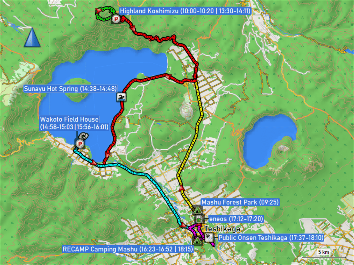
freitag, 13-jun-2025: teshikaga (mount mokoto + wakoto halbinsel) kilometerzähler: 97 km (GPS: 98 km) / wanderungen: 10.9 km |
 tagebuch |
fahrt vom campingplatz mashu forest park bei teshikaga zum parkplatz beim highland koshimizu trailhead (31.0 km / 31.4 km)
rundwanderung vom parkplatz highland koshimizu zum mount mokoto und via ginreiso hut zurück zum parkplatz (7.6 km)
fahrt vom parkplatz highland koshimizu via sunayu hot spring zum parkplatz beim wakoto field house (36.5 km / 37.0 km)
rundwanderung ab dem parkplatz beim wakoto field house um die wakoto halbinsel (3.3 km)
fahrt vom parkplatz beim wakoto field house zum RECAMP camping mashu in teshikaga (18.1 km / 18.4 km)
-
fahrt vom RECAMP camping mashu via eneos tankstelle zum öffentlichen onsen in teshikaga und zurück zum campingplatz (11.4 km / 11.6 km)
|
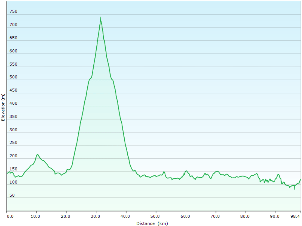
höhenprofil der fahrten und wanderungen rund um teshikaga.
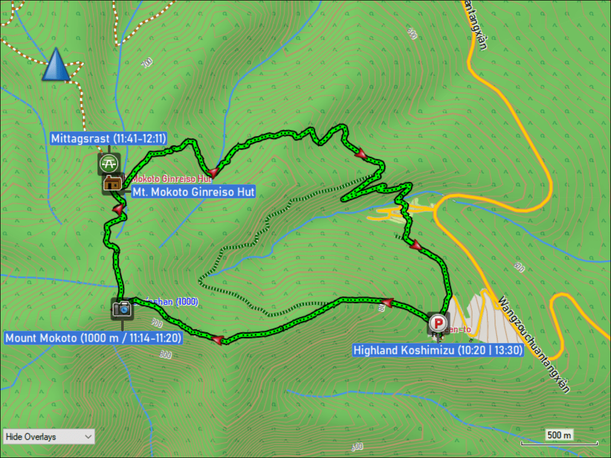
wegstrecke der rundwanderung vom parkplatz highland koshimizu zum mount mokoto und via ginreiso hut zurück zum parkplatz (7.6 km).
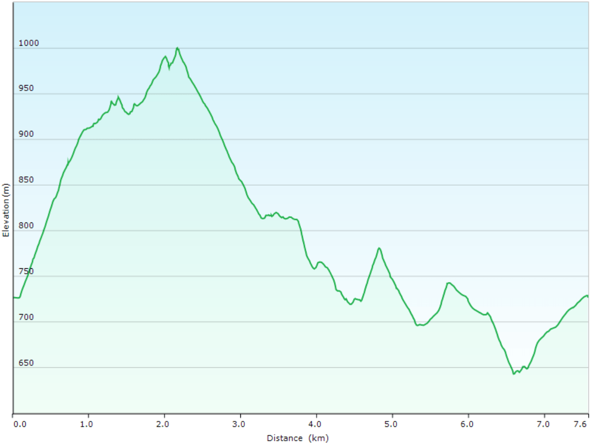
höhenprofil der rundwanderung vom parkplatz highland koshimizu zum mount mokoto und via ginreiso hut zurück zum parkplatz.
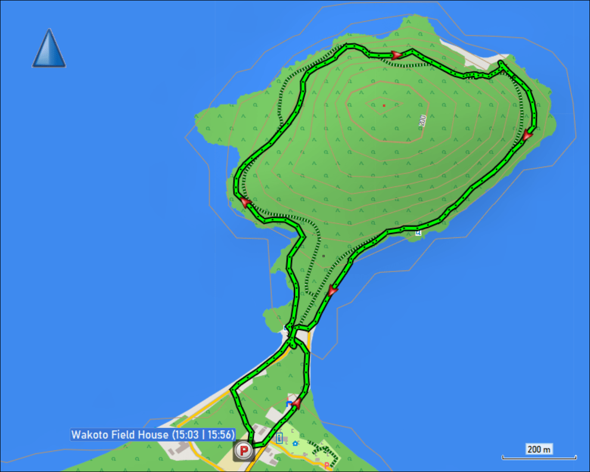
wegstrecke der rundwanderung ab dem parkplatz beim wakoto field house um die wakoto halbinsel (3.3 km).
gestern | tagebuch | inhaltsverzeichnis | übersichtskarte | morgen
karte.html | 10-nov-2025 | the ambis